Sutlej River Pollution | UPSC | Why In The News ?
Pollution in river Sutlej has posed serious health threats to the people living around the Indira Gandhi Canal.
The National Green Tribunal directed the Punjab and Rajasthan governments to submit quarterly compliance reports to Union Ministry of Jal Shakti (water resources), about the remedial action being taken to curb the inflow of effluent discharge into the Satluj and Beas.
Key Points : Source of Sutlej’s Pollution
| Buddha Nallah (Tributary) |
|
| High Biological Oxygen Demand (BOD) |
|
| Leather Industry |
|
Component of Pollutants:
- Mercury
- Lead
- Chromium
- Cadmium
- Selenium
- Heavy Metals
- Pesticides
Read Also : Biological Diversity Act 2002 | UPSC
What is The Impact Of Sutlej River pollution on Indira Gandhi Canal ?
- The Indira Gandhi Canal is the longest canal in the country
- It provides water to 1.75 crore people living in 7,500 villages across eight districts in the state.
- It starts from Harike Barrage, a few kilometres below the confluence of the Satluj and Beas rivers in Punjab, flows through Ludhiana and terminates in the Thar Desert in northwest Rajasthan.
- The canal is a source of drinking and irrigation in the north and western Rajasthan.
- The pollution has caused several health complications among people such as skin diseases, gastroenteritis, indigestion and loss of eyesight.

About Sutlej River :
- The ancient name of Sutlej River is Zaradros (Ancient Greek) Shutudri or Shatadru (Sanskrit).
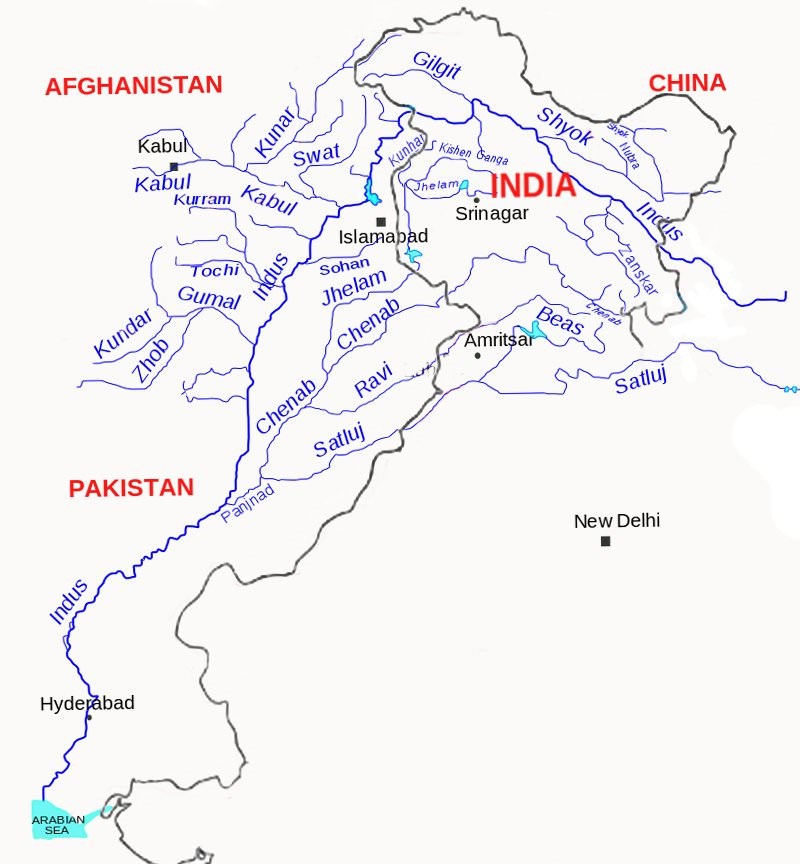
- The Satluj rises from the Manasarovar-Rakas Lakes in western Tibet at a height of 4,570 m within 80 km of the source of the Indus.
- Like the Indus, it takes a north-westerly course upto the Shipki La on the Tibet-Himachal Pradesh boundary.
- It cuts deep gorges where it pierces the Great Himalaya and the other Himalayan ranges.
- Before entering the Punjab plain, it cuts a gorge in Naina Devi Dhar, where the famous Bhakra dam has been constructed.
- After entering the plain at Rupnagar (Ropar), it turns westwards and is joined by the Beas at Harike.
- From near Ferozepur to Fazilka it forms the boundary between India and Pakistan for nearly 120 km.
- During its onward journey it receives the collective drainage of the Ravi, Chenab and Jhelum rivers.
- It joins the Indus a few kilometres above Mithankot.
- Out of its total length of 1,450 km, it flows for 1,050 km in Indian territory.
Source : Down to earth


